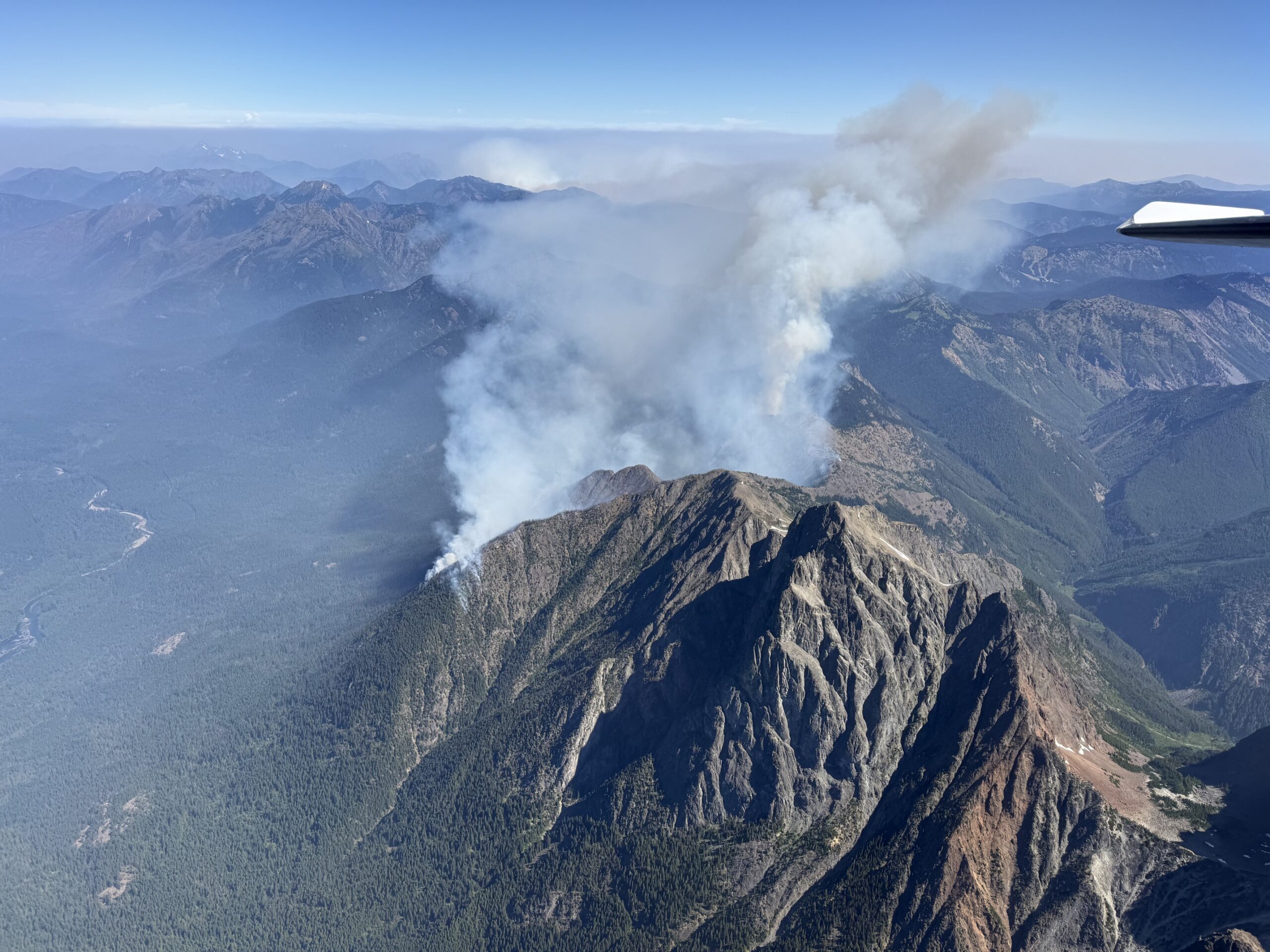
A wildfire burning in remote terrain along the United States and Canadian border in the North Cascades has grown to 300 acres as of July 22, 2026, with fire managers warning that difficult conditions and rugged topography will make suppression efforts challenging in the days ahead. The fire, now known as the Border 2 Fire, originated as two separate lightning-caused blazes that have merged into a single incident burning across steep, densely forested terrain east of Hozomeen Mountain near the north end of Ross Lake.
How the Fire Developed
The Border 1 and Border 2 fires ignited separately in recent days before connecting and combining under the single Border 2 Fire name, according to a July 22 news release from the North Cascades National Park Service Complex. The combined fire has crossed the international boundary into Canada and has also spread east onto Okanogan-Wenatchee National Forest lands, making it a multi-jurisdiction incident involving both U.S. and Canadian fire management agencies.
The fire sits approximately 1.5 miles east of Hozomeen Mountain, a remote area accessible primarily by boat via Ross Lake. There are no roads that reach the area directly, which significantly complicates ground-based suppression efforts. The terrain is described as steep and densely forested, with limited natural firebreaks. A nine-person crew arrived at the Hozomeen area on July 22, traveling by boat from the Ross Lake access point to assist suppression operations. A Type-3 Incident Commander also arrived July 22 and was scheduled to take command of the Border 2 Fire on July 23 under a Type-3 Incident Management organization.
Air resources have played a central role in the suppression effort. An air attack aircraft, a scooper plane, a Type-2 helicopter, and a Type-3 helicopter have been deployed, dropping water and conducting aerial reconnaissance. The Olympic Wildland Fire Module has been assigned to provide structure protection in the area.
What It Means for Ross Lake Recreation
The north end of Ross Lake is closed to all recreational use as a direct result of the fire response. Vessel and foot traffic across the U.S.-Canada border in the area is prohibited. Ross Lake is a popular destination for kayakers, canoeists, and backcountry campers who access the reservoir by boat-up, floating up the lake from the Ross Dam area at the south end. The closure affects campsites, trails, and boat access in the northern section of the lake. Visitors planning trips to Ross Lake are strongly advised to check current closure information before departing. An updated list of trail and campground closures in the North Cascades National Park area is maintained on the park's fire closure page.
Anyone visiting Ross Lake who encounters aircraft scooping water should keep well clear of the collection zones. Interfering with aerial firefighting operations, including by drone or vessel, is prohibited and dangerous. Drones are prohibited in the fire area under a temporary flight restriction to protect firefighter operations.
Fire Conditions and Outlook
The Washington State Department of Ecology noted on July 22 that while the fires burning near Ross Lake do not pose an immediate threat to populated communities, their location in remote terrain will make them difficult to manage, and significant growth is expected. Fire activity is anticipated to be elevated over the next several days due to hot, dry, and windy conditions. A heat advisory remained in effect for Whatcom County lowlands and foothills through July 22, and thunderstorm potential over high terrain on Thursday, July 23, raises the possibility of additional lightning-caused ignitions in the region.
The Washington Department of Natural Resources has the fire danger level in the lowlands rated at High, with the Cascades rated Moderate to High. A Stage 2 burn ban has been in effect across unincorporated Whatcom County since July 17, prohibiting all open burning including campfires, burn barrels, and agricultural burning. The ban remains in effect until further notice.
The Border 2 Fire is one of multiple active fire incidents in the broader North Cascades ecosystem. A separate fire called the Luna Fire was estimated at approximately 22 acres as of July 22, with suppression efforts ongoing using a Type-3 helicopter. Fires burning in British Columbia's Brunswick Creek Complex, located roughly 60 miles north of the border, have burned over 62,000 acres this month and contributed to air quality alerts in Whatcom and Skagit counties earlier this week.
Residents across the county should continue to monitor air quality conditions. The Northwest Clean Air Agency issues air quality alerts for Whatcom County and posts real-time data at their website. Anyone with respiratory conditions should limit outdoor exertion on days when air quality is in the unhealthy range for sensitive groups.