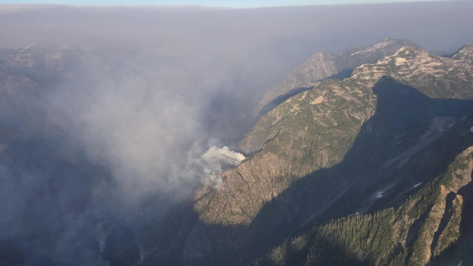
Wildfire containment is improving across Whatcom County and the broader state of Washington as of Tuesday, September 8, with the Luna fire west of Ross Lake now at 34 percent contained and the Border 2 fire to the northeast holding at 73 percent. Air quality in the Whatcom County lowlands remains at moderate levels and is expected to stay there through at least Wednesday, according to the Northwest Clean Air Agency.
The Luna fire has spread to roughly 7,700 acres about 10 miles north of Newhalem, placing it deep in the North Cascades terrain that makes ground access and aerial firefighting difficult. The fire is burning in the Ross Lake area of the North Cascades, a region that sits at the eastern edge of Whatcom County and borders Skagit County to the south. The gradual increase in containment from previous days reflects steady progress by fire crews working in rugged, remote terrain.
Border 2 Fire and the Cross-Border Situation
Northeast of Ross Lake, the Border 2 fire continues to burn across both sides of the international boundary with Canada. The fire has grown to over 23,000 acres total, with the majority of the burned area on the Canadian side and approximately 8,000 acres within the United States. At 73 percent containment, the fire's perimeter on the U.S. side is largely controlled, though full containment has not been declared.
The cross-border nature of the Border 2 fire has required coordination between U.S. and Canadian fire management agencies. The Whatcom County Sheriff's Office Division of Emergency Management confirmed this week that its Emergency Operations Center is not activated in connection with the fires, and that while officials are aware of fire activity in the far eastern part of the county around Ross Lake, Whatcom County emergency management has no direct involvement in fire response activities. The North Cascades National Park Service is the lead agency for fire information on the U.S. side of the border in that area.
A Stage 2 burn ban remains in effect countywide as of this reporting. The ban, which has been in place since July 17, prohibits all open burning throughout Whatcom County. Residents should not conduct any outdoor burning until the ban is lifted, regardless of weather conditions on any given day. The county's burn ban applies to all unincorporated areas and coordinates with city fire codes.
Statewide Fire Picture
While the Whatcom County fires are serious, they are smaller than the two largest fires currently burning in Washington state. The Little Giant fire in Chelan County has burned just over 170,000 acres and is now 81 percent contained, making it by acreage the largest blaze in the state this season. The Sinlahekin fire in Okanogan County has burned approximately 166,000 acres and stands at 67 percent containment.
Both of those Eastern Washington fires are in different climate and terrain conditions than the North Cascades fires affecting Whatcom County, but the statewide intensity of the 2026 fire season has kept resources stretched thin. The Washington State Department of Ecology declared a drought in April 2026 that includes Whatcom County, and most of the county has been classified as abnormally dry for much of the summer, with far eastern parts of the county in moderate drought. Those conditions have contributed to elevated fire danger throughout the season.
Air Quality and What to Watch
Air quality in the Whatcom County lowlands has been largely manageable compared to some years. The Northwest Clean Air Agency is forecasting moderate air quality levels through Wednesday, which means sensitive groups, including people with asthma, elderly residents, and young children, should limit prolonged outdoor exertion but the general public is not advised to stay indoors. Moderate is preferable to the unhealthy or very unhealthy readings that can accompany more severe smoke events.
The DNR fire danger level for the Whatcom County lowlands is currently rated Moderate, with the Cascades also at Moderate. Residents in eastern parts of the county closest to the fire activity should monitor air quality more closely as conditions can shift with wind changes. The Whatcom County Health and Community Services department maintains a wildfire smoke information page with up-to-date air quality readings and health guidance.
With containment improving on both local fires and the weather pattern expected to bring some light showers by Thursday and Friday, fire managers are cautiously optimistic about the coming week. Residents in the eastern county near Glacier, Maple Falls, and the North Fork Nooksack corridor should continue monitoring county alerts and the North Cascades National Park fire information page for any changes to evacuation levels or access restrictions near the fire areas.