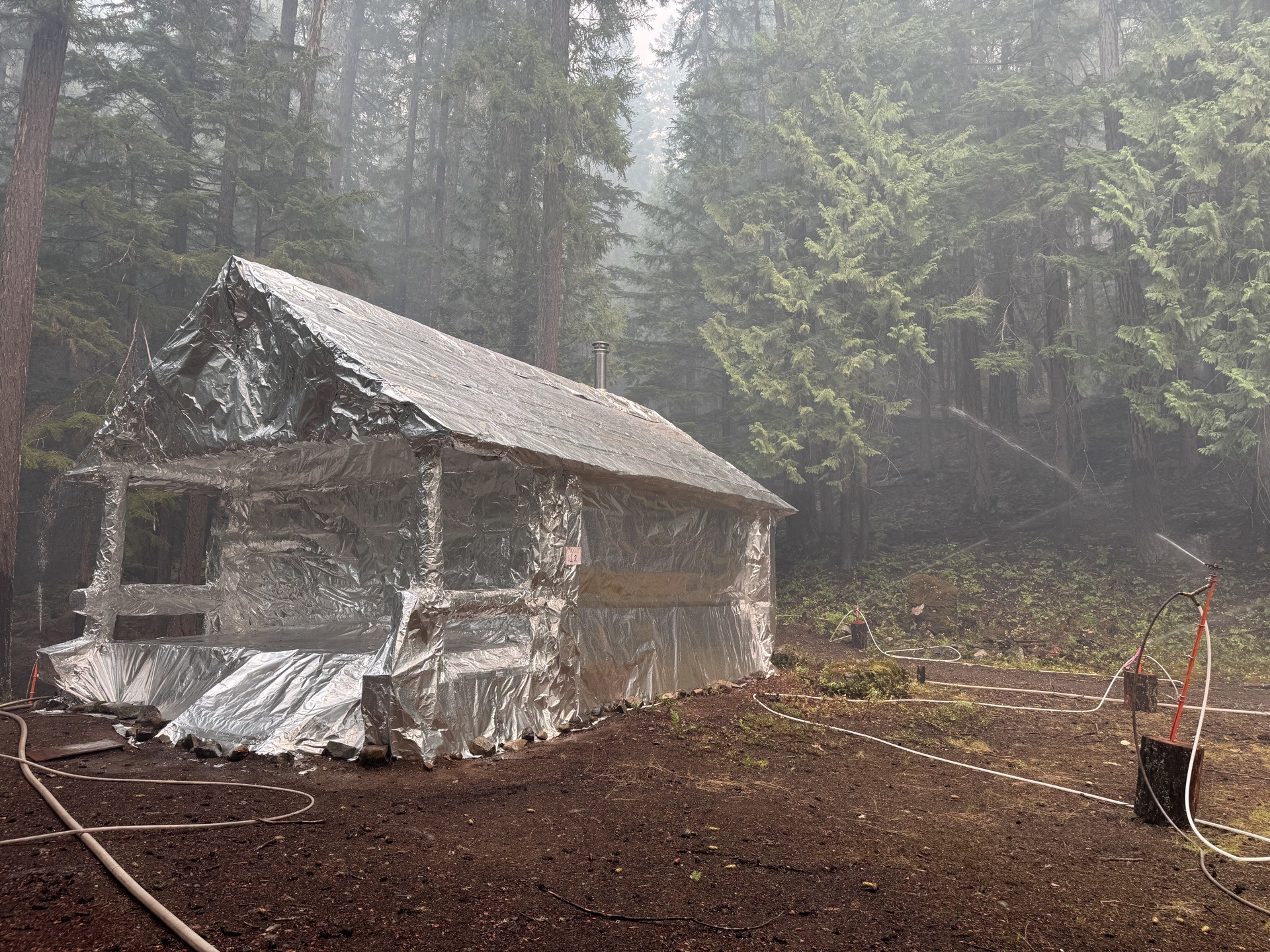
Two wildfires burning in the remote North Cascades on the eastern edge of Whatcom County continued to grow over the weekend, with neither fire showing any containment as of Monday morning, August 10. Dry and warm conditions through the weekend accelerated the spread of both fires, which were sparked by lightning in late June and mid-July. The fires are burning in among the most rugged terrain in Washington State, creating significant challenges for firefighting crews and prompting protective operations at remote structures and backcountry camps.
Where the Fires Are Burning
The Border 2 Fire is burning near Ross Lake in the northeastern corner of Whatcom County, in steep and remote terrain on the northeast side of the lake that extends into Canada. As of Monday morning, the fire had spread to just over 10,500 acres and remained entirely uncontained. Crews are actively working to protect structures in the Hozomeen area, a remote outpost at the northern end of Ross Lake accessible only by boat or a long dirt road from the Canadian side of the border. The fire is slowly moving south along Little Jackass Mountain, a ridge that rises sharply above the lake's eastern shore.
Just west of Ross Lake, the Luna Fire has grown to just over 3,500 acres and also has zero containment as of Sunday. The Luna Fire is burning approximately 10 miles north of Newhalem, the small company town that serves as the gateway to Seattle City Light's hydroelectric operations in the upper Skagit Valley. The dams and associated infrastructure in that corridor are vital to the power supply for the Seattle metro area, and fire activity in the vicinity heightens attention to the region even when the specific structures are not directly threatened. Firefighters have been working to protect the Beaver Pass area and are preparing to move their protective efforts to the Big Beaver Camp area as conditions develop.
Both fires were started by lightning: the Luna Fire ignited on June 24 and the Border 2 Fire followed on July 16. Lightning-caused wildfires in the North Cascades are common during summer thunderstorm activity, when dry conditions following a wet spring allow fires that ignite in remote terrain to grow for weeks before crews can establish meaningful control lines. The terrain where both fires are burning is among the most difficult in Washington State, combining extreme steepness, limited road access, and high elevations that make conventional ground-based firefighting operations nearly impossible in many areas. Much of the area falls within the North Cascades National Park complex, where the National Park Service coordinates closely with state and federal fire agencies on suppression strategy and resource allocation.
British Columbia State of Emergency
The wildfire situation is significantly worse just across the border in British Columbia. BC Premier David Eby issued a province-wide state of emergency on Saturday, August 8, after the growing Bald Range Fire forced the evacuation of more than 20,000 people near Okanagan Lake in the southern interior of the province. The scale of the evacuations reflects the severity of fire conditions across the province, where a combination of drought, record temperatures, and years of accumulated fuel load have created conditions highly favorable to fast-moving, large-scale fires. BC is currently managing more than 100 active wildfires, and the province's firefighting resources are stretched across a wide geographic area.
Closer to Whatcom County, the Brunswick Complex fires in BC have burned over 155,000 acres near the town of Boston Bar in the Fraser Canyon. Boston Bar sits along the Trans-Canada Highway roughly 100 miles northeast of Vancouver, in a narrow canyon corridor where the Fraser River has carved through the mountains. The scale of the Brunswick Complex represents one of the largest active fire situations in western Canada this season. Smoke from those fires has been moving into Whatcom County since early July, periodically degrading air quality for residents in communities including Sumas, Maple Falls, and the eastern Cascade foothills. The smoke contribution from Canadian fires compounds the local smoke generated by the Border 2 and Luna fires themselves, creating periods of poor air quality that affect a broad area of the county.
What Residents Should Know
The Whatcom County Division of Emergency Management's Emergency Operations Center has not been activated in connection with the current fires, according to Monday's daily briefing. The fires remain in remote areas with no immediate threat to populated communities in the county. However, residents in the eastern portions of the county should monitor air quality conditions closely, particularly if they have respiratory conditions, are pregnant, or are elderly. Children and people who exercise outdoors regularly should also pay attention to daily air quality forecasts before spending extended time outside. The county's DNR fire danger rating for the lowlands is listed as High, with Cascades areas at Moderate to High.
A Stage 2 burn ban has been in effect across Whatcom County since July 17, prohibiting all outdoor open burning including recreational fires, yard debris burning, and the use of outdoor fire pits. The ban remains in place until further notice and reflects the sustained dry conditions that have affected the entire region. Anyone who sees smoke or reports of a new fire should call 911 immediately rather than attempting to investigate or extinguish it independently.
For travelers planning to visit Ross Lake or the North Cascades Highway corridor, conditions around active fire areas can change rapidly. Trail closures, road restrictions, and campground shutdowns can be implemented with little advance notice when fire activity intensifies or shifts direction. The North Cascades National Park Service posts current fire and trail closure information on its website, and checking that page before any trip into the affected area is strongly advisable. The Whatcom County Division of Emergency Management also maintains updated information and encourages all residents to sign up for emergency alerts through WhatcomReady, the county's free notification system for hazard and emergency information.
Residents wanting to track real-time fire activity and smoke forecasts for the region can check AirNow.gov for current air quality index readings at monitoring stations across Whatcom County. The site provides hour-by-hour forecasts and color-coded guidance on when outdoor activity should be limited. For earlier coverage of the North Cascades fire season and how smoke has affected Whatcom County communities this summer, see our report on the fires continuing to spread.