A pair of wildfires burning in steep terrain near the northeast edge of Whatcom County have grown significantly over the past week, with the National Park Service reporting that the Border 2 fire has now spread to approximately 2,500 acres, doubling in size since its last update on Monday, July 27. The fire has been burning on the northeast side of Ross Lake since July 16 and remains 0% contained as of Thursday, July 30.
Further east, an even larger set of fires in Okanogan County has prompted evacuation orders and standby notices for residents, while fire officials warn that dry conditions and shifting winds are likely to continue driving growth across the region.
Border 2 Fire and Luna Fire Near Whatcom County
The Border 2 fire is burning in the remote northeast corner of North Cascades National Park, in terrain characterized by steep slopes and limited road access that makes ground-based firefighting operations difficult and dangerous. The area around Ross Lake, a reservoir stretching nearly to the Canadian border along the Skagit River drainage, is among the most rugged in the park, and the fire's location means air assets play a central role in any suppression effort.
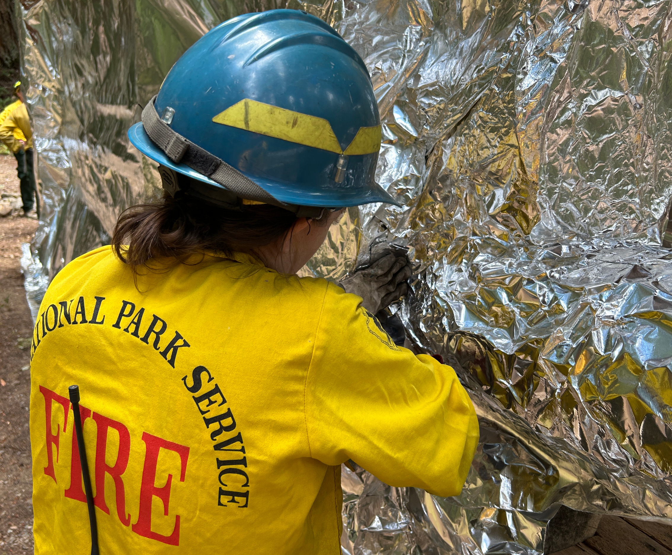
The North Cascades National Park Service has firefighters deployed to the area and has been wrapping structures in flame-retardant material as a precaution. Despite the fire's doubling in size, the remote location means direct risk to populated areas within Whatcom County remains limited at this time. Whatcom County's Division of Emergency Management has noted awareness of the fires but confirmed its Emergency Operations Center is not currently activated in response.
The Luna Fire, burning approximately 10 miles north of Newhalem along the upper Skagit corridor, has remained at roughly 330 acres as of the latest update. Newhalem, a company town operated by Seattle City Light at the head of its Skagit hydroelectric complex, sits downstream from the Luna Fire's current perimeter. Highway 20, which serves as the primary access route to the North Cascades, has experienced periodic closures and restrictions this summer related to fire activity in the corridor.
Major Fires Burning East of Whatcom County
The larger fire emergency is unfolding just east of Whatcom County in Okanogan County, where three significant fires are burning simultaneously. The Ptarmigan Fire has more than tripled in size since the start of the week, now burning at 18,000 acres. The Sinlahekin Fire near Loomis, ignited by lightning on Sunday, July 26, has grown to an estimated 10,527 acres in steep, rugged terrain that is continuing to spread. Some residents near the Sinlahekin Valley have been ordered to evacuate, while many others are on standby to leave on short notice.
Washington State has approved emergency fire assistance for the Okanogan fires, deploying six additional firefighting teams and supporting resources. The Kaiser Canyon Fire north of the Columbia River, which ignited nearly two weeks ago, has burned approximately 130,000 acres in Okanogan County and is only 27% contained, though its rate of growth has slowed compared to earlier in its progression.
The scale of fire activity in Okanogan County is notable even by the standards of Washington's historically fire-prone eastern and central highlands. Okanogan County has experienced some of the most destructive wildfires in Washington State history in the past decade, and 2026 is shaping up as another significant fire year for the region.
Air Quality and Local Conditions in Whatcom County
Whatcom County's Emergency Management Daily Briefing for Thursday reported that air quality is currently good for most areas of the county, with no active advisories, watches, or warnings in effect. The Washington Department of Natural Resources fire danger level for the lowlands of Whatcom County is rated High, with the Cascades at Moderate to High, reflecting the dry conditions that have persisted through July.
A Stage 2 burn ban has been in effect across Whatcom County since July 17, prohibiting all open burning. Residents are reminded that even small burning activities, including backyard fire pits and agricultural debris burns, are prohibited under the Stage 2 ban. Violations can result in fines, and the risk of accidental ignition is elevated across the county given the dry conditions.
The Whatcom County Division of Emergency Management encourages residents to sign up for emergency alerts through WhatcomReady to receive notifications if conditions change. Air quality conditions in Whatcom County can shift quickly when smoke from eastern Washington and Oregon fires moves west through the Cascade passes under certain wind patterns. Residents with respiratory conditions are advised to monitor air quality conditions at the Northwest Clean Air Agency website, which provides up-to-date readings for monitoring stations across Whatcom County. More on fire conditions and emergency preparedness resources in the region is available in earlier coverage of North Cascades access and conditions.