A new free program is making it easier to explore Bellingham by bike, whether you are a longtime resident who thinks you already know every corner of the city or a visitor looking for something more personal than a standard tourist itinerary. BIKE Bellingham launched this spring, offering a set of themed self-guided cycling routes accessible through a free downloadable app called Ride with GPS. The program was created and self-funded by a single individual with a deep background in bicycle travel, and it reflects a genuine philosophy about what cycling can do for the way people experience a place.
How the Program Works
Each BIKE Bellingham route is available through the Ride with GPS app, which is free to download on iOS and Android. Once downloaded, riders can access routes that range from 5 to 25 miles and include turn-by-turn navigation, detailed descriptions of road surface conditions, and annotated stopping points that explain the landscape, local businesses, public art, and other points of interest along the way. The surface condition information is particularly useful in Bellingham, where routes can transition between paved bike lanes, packed gravel paths, and hillier residential streets depending on the neighborhood.
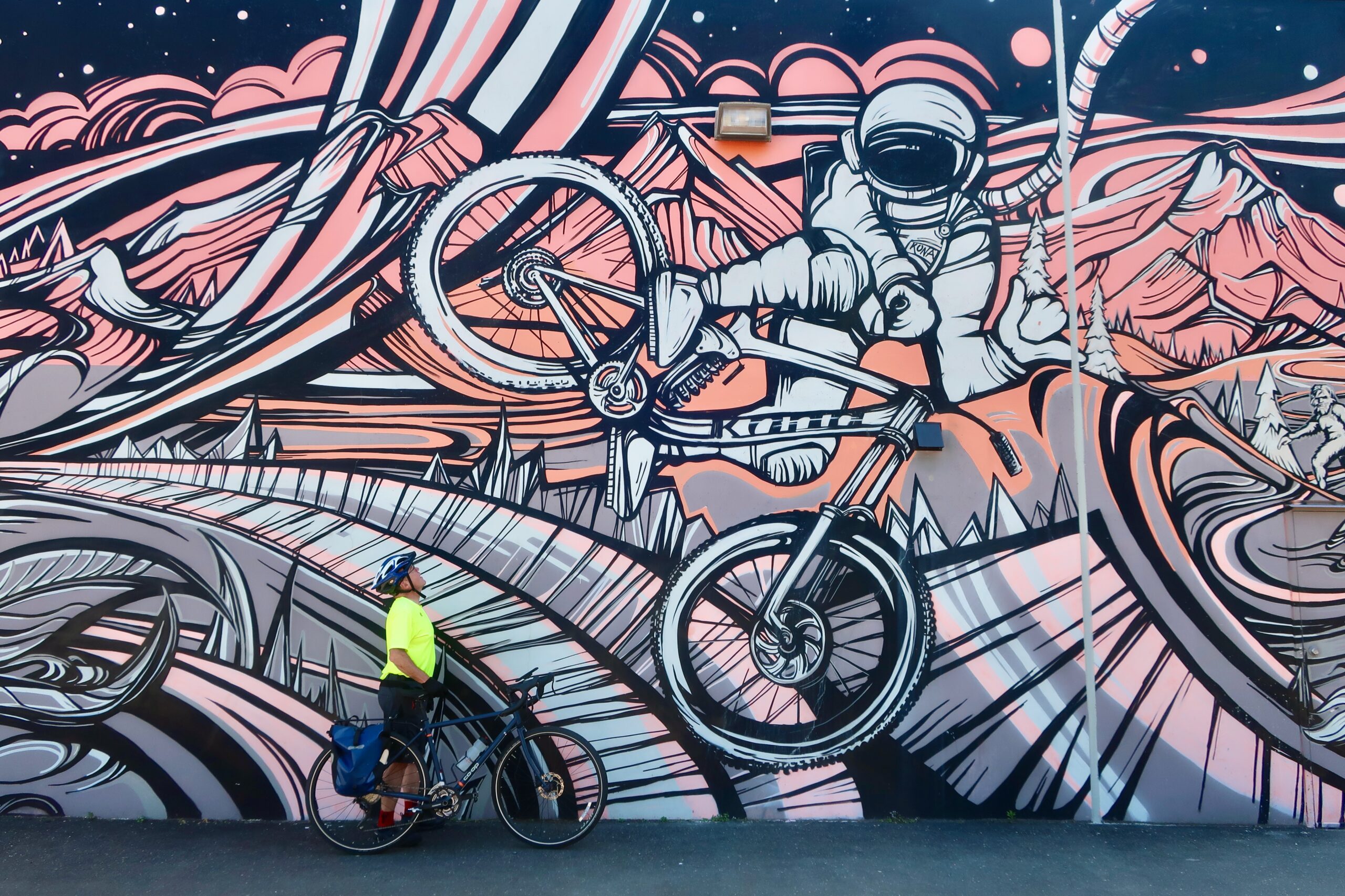
Routes are themed. One follows murals by Bellingham artist Gretchen Leggitt, including her "Astrowhip" piece at the former Kona Bike Shop. Another, called "Quirky Quirks," takes riders past unexpected landmarks including a giant stray KFC bucket that has become something of a local landmark. The idea is to draw attention to the places that people drive past every day without noticing, the in-between spots that hold unexpected stories and that only become visible when you slow down enough to actually look at them.
The program's founder, Sarah Burch, said the routes are built to be accessible to riders of all abilities. "You don't have to be a technical mountain biker or have a fancy bike or be in super great shape," Burch said. That philosophy of accessibility is central to the program's design: the range of distances and the range of terrain descriptions are intended to let riders self-select something appropriate for their current fitness and equipment rather than having to guess. Each route took approximately 40 hours to plan and develop, which speaks to the level of research and on-the-ground exploration that went into each one. Burch created and self-funded the program after moving to Bellingham in 2024 following 12 years of nomadic travel, much of it by bicycle across the Pacific Northwest, Alaska, and Patagonia.
The Philosophy Behind BIKE Bellingham
Burch said her inspiration came from what bike travel had done for her own relationship to place. Traveling by bike taught her to slow down and notice the things that cars blur past. Over twelve years of cycling through some of the most remote and visually dramatic landscapes in the Western Hemisphere, she developed a habit of paying attention to the details that most travelers skip, a practice that translated naturally into the way she built routes once she settled in Bellingham. That curiosity about the in-between is baked into every route. "I look at those places, and I ask the questions, 'Why is it there? What's the story behind it?'" she said.
The program is built from what Burch calls a traveler's perspective, which tends to surface details that locals have long since stopped seeing. That outside eye is part of what makes the routes feel different from, say, a city-produced map of parks and viewpoints. The stopping points are chosen for their story potential, not their Instagram appeal. The result is a set of routes that function less like a highlights reel and more like a conversation with someone who has spent time really looking at Bellingham rather than just passing through it.
Burch's broader motivation is to make the transformative experience of bicycle travel available without barriers. "Bike travel has been so influential to me in changing my life and how I see the world, and I just wanted to make sure that other people could have that same experience without any barriers to entry," she said. By keeping the program free, using a free app, and designing routes for a range of fitness levels, she has tried to remove as many obstacles as possible between the idea of exploring by bike and actually doing it.
Bellingham has long positioned itself as a bike-friendly city, with the City of Bellingham maintaining an extensive network of on-street bike lanes and the Interurban Trail system connecting neighborhoods from south Bellingham toward Larrabee State Park. BIKE Bellingham operates independently of the city but complements those existing infrastructure investments by giving riders a reason to use the network in new ways and by directing attention to parts of the city that formal infrastructure planning does not always highlight.
What Riders Can Expect This Summer
July and August offer some of the best cycling conditions Bellingham sees all year, with longer days, drier roads, and relatively mild temperatures. The city's topography does involve hills, but the BIKE Bellingham routes are described with surface conditions and difficulty context, allowing riders to choose something appropriate for their fitness level and equipment. Someone on a hybrid bike looking for a relaxed two-hour ride will find options that work for them, and a more experienced cyclist looking for a longer, hillier loop will also find something to suit.
For visitors, the program offers a genuinely low-cost way to explore the city. There are no fees to access the routes, and the Ride with GPS app's free tier includes everything needed to follow the navigation. Bike rentals are available through several Bellingham shops for those who do not travel with their own equipment, and the city's compact geography means that most of the BIKE Bellingham routes are accessible from central Bellingham without needing a car to reach the trailhead.
For longtime residents, the routes offer a different kind of value: the chance to see a familiar city through fresh eyes. Bellingham has accumulated decades of public art, neighborhood history, and quietly significant places that most residents pass without knowing their stories. A themed bike route that connects those dots, explains what the murals mean, points out the oddities that have become invisible through familiarity, and frames the city's geography through a cyclist's eyes can be surprisingly revealing even for someone who has lived here for years.
More information about BIKE Bellingham routes and how to download the app is available through the program's website. For related coverage of outdoor and active recreation in Whatcom County, see earlier reporting on Bellingham's trails advocacy nonprofit and its county-wide network plans. The Whatcom County tourism office also maintains a guide to cycling resources at bellingham.org.