A local advocacy group called Safe Streets for Bellingham has planted dozens of yellow yard signs across the city, specifically at locations where pedestrians or cyclists have been hurt or killed in traffic crashes. The signs are meant to draw attention to a safety problem the group argues the city has been too slow to address, and they come with a concrete set of proposals for change.
The Scale of the Problem
According to data from the Washington State Department of Transportation's crash data hub, Bellingham has seen 20 fatal pedestrian and bicycle crashes over the past 10 years. That number, while it may sound modest in isolation, represents a significant toll for a city of roughly 95,000 people -- and it does not include the far larger number of non-fatal crashes that left cyclists and walkers with serious injuries.
Safe Streets is proposing changes covering more than 12 miles of what the group identifies as priority roads in Bellingham. The specific roads were selected based on crash history and the vulnerability of people walking and biking along them. The group's analysis points to streets where the combination of traffic speeds, lane design, and lack of physical separation between vehicles and non-motorized users creates elevated risk.
The pattern of crashes in Bellingham reflects a challenge familiar to many Pacific Northwest cities that grew their street networks around automobile access during the postwar decades. Wide arterials that move cars efficiently tend to create hostile conditions for people on foot or bike. Bellingham's topography, with its hills, creek corridors, and neighborhoods separated by busy arterials like Meridian Street, Alabama Street, and Sunset Drive, means that many walking and cycling routes require crossing or riding along roads that were not designed with non-motorized users in mind. The 20 fatal crashes over 10 years represent the most severe outcomes of that mismatch, but near-misses and serious injuries occur at a much higher rate and are systematically undercounted in crash databases because many go unreported to law enforcement.
What Safe Streets Is Proposing
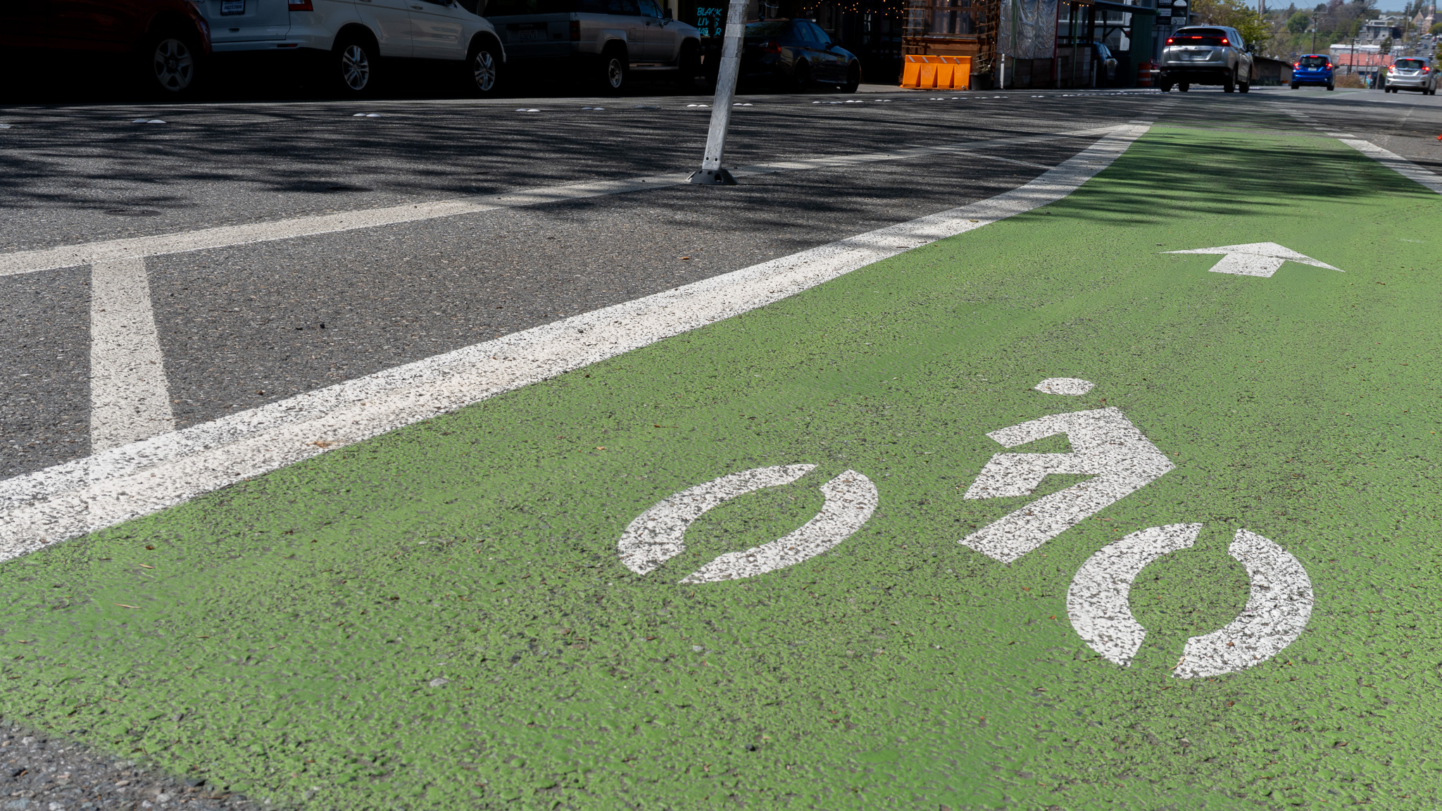
The group has put forward two main categories of improvements. The first focuses on existing infrastructure: installing more painted vertical posts in current bike lanes to provide physical separation between cyclists and moving traffic, and converting some on-street parking to new dedicated bike lanes where right-of-way constraints make adding a protected lane otherwise impossible.
The second phase involves a neighborhood-level "Slow Streets" initiative modeled on a similar program that has been implemented in San Francisco. Under that approach, individual neighborhoods could designate streets where speed limits are reduced to encourage more walking and biking activity. The program would be driven by neighborhood interest rather than imposed citywide, giving residents a direct role in deciding which streets in their area would be slowed.
The group notes that the City of Bellingham approved master plans for bicycle and pedestrian infrastructure in 2024. Safe Streets is not opposing those plans. Instead, the group argues that more work can be done in a shorter timeframe to reduce accidents before the longer-term capital improvements from the master plan are built out. Physical separation and speed management are among the lowest-cost, fastest-to-implement tools available for reducing crash severity.
The painted vertical post approach deserves particular attention as a near-term strategy. Flexible delineator posts can be installed in existing bike lanes within days of a decision to proceed, at a fraction of the cost of reconstructed curbs or dedicated cycle tracks. Research from cities that have deployed them at scale shows meaningful reductions in wrong-way entries and vehicle incursions into bike lanes. They are not a permanent substitute for protected infrastructure, but they reduce risk while more substantial projects work their way through the capital improvement planning and construction process, which in most cities takes several years from approval to ribbon-cutting.
How Yard Signs Fit the Strategy
The yard signs are an intentional visibility strategy. By placing them at actual crash sites, Safe Streets is making the abstract problem of traffic violence concrete and geographic. Drivers, cyclists, and pedestrians who pass a sign at a particular intersection see not just a message about safety, but a marker of a real incident that happened in that specific place. The approach has been used by advocacy groups in other cities to build community awareness and political will for infrastructure changes.
Crash locations in Bellingham include intersections and road segments across the city, from Whatcom Creek Trail crossings to arterial streets in neighborhoods like Birchwood, Samish, and the Lettered Streets area. Making those locations visible is the first step toward generating public pressure for improvements at specific sites.
Washington State's WSDOT Crash Data hub is publicly accessible and allows residents to look up crash history by location, providing a useful tool for anyone who wants to understand the safety record of a specific road or intersection in their neighborhood.
What Comes Next
Safe Streets for Bellingham has not announced a specific meeting or public comment process tied to their proposal, but advocacy campaigns of this type typically build toward engagement with the city's public works and planning departments. The 2024 bike and pedestrian master plans provide a framework that the city's capital improvement planning process uses to prioritize projects. Residents who want to see faster implementation can contact their city council representative or attend public works-related council meetings where transportation projects are discussed.
For families with children who walk or bike to school, or for commuters who rely on non-motorized transportation to get around Bellingham, the Safe Streets proposals represent a direct quality-of-life issue. More information on the group's work and how to get involved is available through the City of Bellingham. For related coverage of Bellingham transportation planning, recent reporting on parking policy changes provides useful context on how the city is rethinking its streets.